Riding the Ho Chi Minh Trail through Phong Nha: a guide
The Hang & Trail team · April 24, 2026
The Western Branch of the Ho Chi Minh Trail runs straight through the national park. Here is what it is, what to see, and how to ride it.
The short answer
This is one of the best rides in Vietnam, and you can do the headline stretch in a half day from Phong Nha town. The road west into the national park is paved, smooth and nearly empty, and it runs past real war history on the way. Rent a bike for about $6 to $10 (150,000 to 250,000 VND) a day, fill the tank, and ride out on Highway 20 toward the Eight Ladies memorial and Tra Ang. That short loop is 50 to 60km return and takes a relaxed half day with stops. Prices checked June 2026.
If you want more, the same network keeps going. The Western Ho Chi Minh Road carries on south for roughly 230km of empty mountain riding all the way to Khe Sanh, which makes a one or two day trip if you have your own bike and some confidence. Below is what the road actually is, the stops worth slowing down for, and the honest version of fuel and safety.
The trail versus the road, cleared up
First, the thing that confuses people. The Ho Chi Minh Trail was never a single road. It was a sprawling web of footpaths, truck roads, river crossings, fuel pipelines and tunnels running through Vietnam and Laos, used by the North to move soldiers and supplies south during the war. It shifted constantly because it was bombed constantly. So there is no one original 'trail' you can ride.
What you ride today is the modern Ho Chi Minh Road, a national highway built largely in the 2000s that follows and revives parts of the old wartime network. Through Quang Binh it splits into an eastern and a western branch. The western branch, Duong Ho Chi Minh Tay, is the good one: it threads through the heart of Phong Nha-Ke Bang on quiet paved tarmac. Branching off it near the park entrance is Highway 20, the old wartime Road 20 Quyet Thang, which is where most of the history sits.
Road 20 Quyet Thang, the historic stretch
Road 20 is the one with the story. The name means 'Determined to Win,' and it was hacked through the mountains by youth volunteers and engineers starting in December 1965, finished in just over five months by May 1966. It runs about 125km from its Km 0 near Xuan Son, just outside Phong Nha, west to the Laos border. It was a key choke point on the supply route, which meant it was bombed relentlessly, and the people who kept it open paid for it.
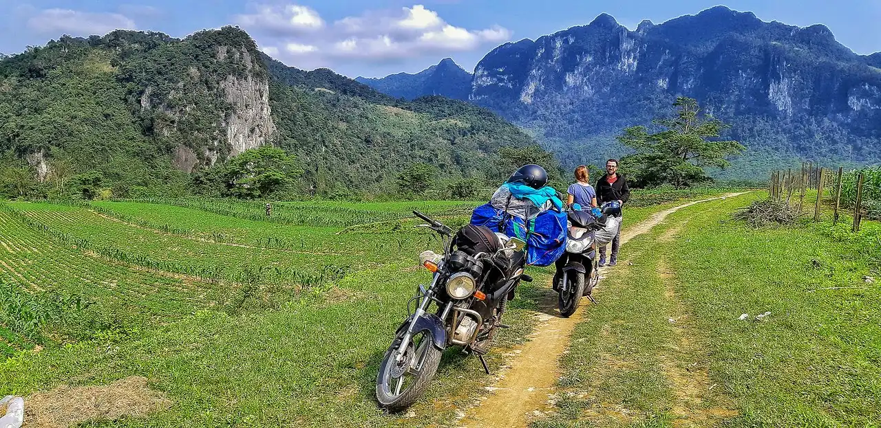
To pick it up, ride upriver through Phong Nha town and turn for Highway 20, which leads straight into the park. The road is in good shape, paved and well graded, with the kind of forest-and-karst scenery that makes you keep pulling over. This is the section you can comfortably ride as a half day.
The day loop from Phong Nha town
For most travelers, this is the ride. Start by 8am, head out on Highway 20, and you can be deep in the national park within half an hour. The standard out-and-back to the Eight Ladies and Tra Ang area runs roughly 50 to 60km return and fills a relaxed half day with stops, swims and slow looking.
Rough order of what you pass riding west: the turn for the Bong Lai valley and its farm bars sits near the start if you want to tack one on, then the Botanic Garden, then the climb into proper jungle where the limestone towers close in around the road. The Eight Ladies memorial and the Tra Ang turn-off come deeper in. You can ride further toward the remote Arem minority village on fully paved road if you want the empty miles, then turn around and come back the way you came. There is almost no traffic out here, which is half the pleasure and also why you carry water and don't count on a shop.
The stops worth slowing down for
Hang Tam Co, the Eight Ladies Cave, is the heart of it. On 14 November 1972 a US bombing run dislodged a huge boulder across the mouth of a roadside cave where eight young volunteers, aged 18 to 20 and most from Thanh Hoa province, had sheltered. Soldiers nearby could hear them calling for days and couldn't move the rock in time. The site was made a national relic in 1988, and a temple was built here in 2006 to honour them and hundreds of others who died keeping the road open. Incense still burns at the cave mouth.
Tra Ang is the swimming stop. It's a cave with an underground river on Road 20, reached by a 20 to 30 minute walk through dense jungle off the road. It's quiet, natural and a world away from the boardwalk caves. You can swim into it on a guided day trip, which is the usual way to do it.
Near where Highway 20 meets the western road, look out for the old Khe Gat airfield. Vietnamese engineers built it near Phong Nha in 1969, and in April 1972 two MiG-17s that had been carried down the trail in pieces and reassembled here flew a surprise strike on US Navy ships in the Gulf of Tonkin, hitting the destroyer USS Higbee. There's little left to see, but the story is worth knowing as you ride past.
The multi-day ride toward Khe Sanh
If the day loop leaves you wanting more, the western branch keeps going south and turns into one of the great long rides in the country. From the Khe Gat junction near Phong Nha, the kilometre markers count down from 237 to 0, and that whole stretch to Khe Sanh is empty, paved mountain road through jungle and karst with hardly another vehicle on it. Allow a long one day push of 6 to 8 hours of actual riding, or split it over two days and enjoy it properly.
The natural place to break it is Long Son village, roughly halfway, which has simple guesthouse rooms and, importantly, a fuel station. From Khe Sanh you're at the western end of the old DMZ, an hour or so from Highway 1, and well placed to carry on to Hue. That makes a tidy two or three day route: ride the western road south, sleep at Long Son, see Khe Sanh and the DMZ war sites, then drop into Hue. You can rent in Phong Nha and arrange to leave the bike in Hue with some rental places, so confirm that before you set off rather than after.
Renting your own bike versus an easy rider
If you can ride and the day loop is your plan, rent your own. A semi-automatic or manual bike runs about $6 to $10 (150,000 to 250,000 VND) a day from guesthouses and rental shops in Phong Nha town, and fuel is cheap. The day loop is well within reach of a careful beginner because the road is good and the traffic is light. Prices checked June 2026.
If you don't ride, or you want the history explained as you go, take an easy rider. A local guide drives, you sit on the back or follow in a jeep, and a good one turns the markers into stories, especially at Hang Tam Co where the context is the whole point. Reckon on roughly $40 to $70 for a guided day. It costs more than going alone, but for this particular road, where the meaning is in things you'd ride straight past, it's money well spent. For the long Khe Sanh run, an experienced guided trip also solves the fuel, navigation and bike-drop-off headaches in one go.
Fuel, safety and the honest caveats
Fuel is the thing to take seriously the moment you leave the day loop. On the western road south, the petrol stations are sparse and unreliable: there's basically one at Long Son around halfway, and one nearer the Khe Sanh end, and either can be closed or out of supply. Start every day with a full tank, and for the long stretch carry a 1.5 litre bottle of spare petrol. For the half-day loop near town you're fine on one tank, but still leave full.
The rest is common sense that people ignore. Wear a proper helmet, closed shoes and long sleeves, because the sun out here is fierce and a slide on quiet tarmac still takes skin. Phone signal drops out in the park, so tell someone your plan and don't rely on maps loading. Watch for buffalo, gravel on the bends and the odd landslip after rain. Don't ride this road after dark, it's unlit and the corners are blind. And go easy in the wet season, roughly September to November, when the mountain sections can flood or wash out.
One last thing that isn't about safety. For a lot of Vietnamese, this is a place of mourning, not a photo stop. Veterans and families come to Hang Tam Co to grieve. Dress modestly, keep your voice down at the memorials, and if you want to light incense, do it sincerely. You're riding through someone's history, so ride through it with some respect.
Common questions
Can I ride the Ho Chi Minh Road from Phong Nha to Hue in one day?
You can, but it makes for a very long day. The western road runs roughly 230km from the Khe Gat junction to Khe Sanh, which is 6 to 8 hours of actual saddle time before you even reach Highway 1 for the final run into Hue. On empty mountain road with sparse fuel that is a big push, so most riders break it at Long Son village around halfway, see Khe Sanh and the DMZ war sites the next morning, then drop into Hue. Confirm with your rental shop in Phong Nha that you can leave the bike in Hue before you set off, not after.
Is the day loop on Road 20 safe for a beginner rider?
Mostly yes. The headline stretch into the park is paved, well graded and almost empty of traffic, which makes the 50 to 60km out-and-back to the Eight Ladies and Tra Ang area manageable for a careful beginner. The real hazards are the sun, the odd patch of gravel on a bend, buffalo on the road and landslips after rain rather than traffic. Leave with a full tank, carry water, wear a proper helmet and closed shoes, and turn back before dark since the road is unlit. If you have never ridden at all, take an easy rider instead.
Do I need a guide for the Ho Chi Minh Trail, or can I do it alone?
For the day loop near town you do not need one, the road is good and the navigation is simple. A guide earns its keep on the history and the long run. At Hang Tam Co and the old Khe Gat airfield the meaning sits in things you would ride straight past, and a good easy rider turns the kilometre markers into stories for roughly $40 to $70 a day. For the multi-day push to Khe Sanh, a guided trip also solves the fuel, navigation and bike-drop-off problems in one go. Prices checked June 2026.
Want this turned into a real plan? Plan my trip →